The Amsterdam Time Machine is working on several different applications, each illustrating a part of the ATM philosophy. In the Jewish Quarter project, the subject of an earlier post, the central goal is to connect datasets from different archives and museums that enable story telling about people, houses, and events over the past centuries.
With the financial support of the Dutch Digital Heritage Network and the Amsterdam University Fund the ‘Straatlevens’ website has emerged, linking datasets to Adamlink, the referenc e database for historical addresses in Amsterdam. Thanks to our University Library the ATM has constructed a knowledge graph which interconnects datasets, merging historical sources to offer an in-depth view of the neighborhood’s history. The pilot, using TriplyDB software, is now managing over 10 million triples from diverse datasets, showcasing the ATM’s commitment to accessible data. Challenges such as entity disambiguation and dataset standardization will be addressed in the coming months. Initial focus on Jodenbreestraat and Nieuwe Amstelstraat, both meticulously studied by the Jewish Museum, lays the groundwork for broader exploration. Recently the former neighborhood of Vlooienburg has been added.
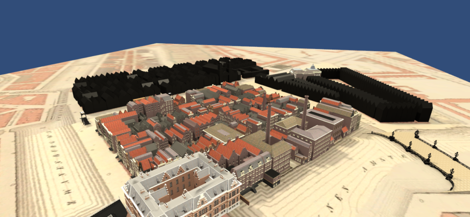
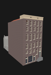 3D visualizations developed by our colleagues of the 4D Research Lab have been developed to evoke the feeling of Google Earth. Each individual house of this visualisation is available as a separate gLTF file and connected to a unique Adamlink location identifier. The aim is to realize the prototype in collaboration with the Jewish Museum and the Rembrandt House Museum for use in an exhibition about the Jewish Quarter in the course of 2025 – the Amsterdam 750 jubilee.
Looking forward, the pilot aspires to scale its application across Amsterdam, showcasing relevance beyond humanities while at the same time offering more interconnected data about Amsterdam’s rich history.